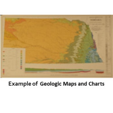
Geologic Maps and Charts

Geologic Maps and Charts (GMCs) show varied conditions related to the state's geology.
-

Seismotectonic Maps of Eastern Nebraska and Parts of Iowa, Kansas, and Oklahoma -- Earthquake epicenter and seismic station location map (GMC-23.2)
$25.00 -

Seismotectonic Maps of Eastern Nebraska and Parts of Iowa, Kansas, and Oklahoma -- Lineament map (GMC-23.3)
$25.00 -
Seismotectonic Maps of Eastern Nebraska and Parts of Iowa, Kansas, and Oklahoma -- Geologic bedrock map (GMC-23.4)
$25.00Sold out
-

Seismotectonic Maps of Eastern Nebraska and Parts of Iowa, Kansas, and Oklahoma -- Precambrian configuration map (GMC-23.6)
$25.00 -

Seismotectonic Maps of Eastern Nebraska and Parts of Iowa, Kansas, and Oklahoma -- Bouguer gravity anomaly map (GMC-23.7)
$25.00 -

Seismotectonic Maps of Eastern Nebraska and Parts of Iowa, Kansas, and Oklahoma -- Aeromagnetic map (GMC-23.8)
$25.00 -

Seismotectonic Maps of Eastern Nebraska and Parts of Iowa, Kansas, and Oklahoma -- Precambrian rock type map (GMC-23.9)
$25.00 -
Geologic Map Showing Configuration of the Bedrock Surface, North Platte 1 x 2 Degree Quadrangle, Nebraska (GMC-26)
$8.50 -
Quaternary Geologic Map of the Platte River 4 x 6 Degree Quadrangle, United States (GMC-27)
$8.50 -

Geologic Bedrock Map of Nebraska (GMC-3)
$25.00 -
Geologic Map of the Scottsbluff 1 x 2 Degree Quadrangle, Nebraska and Colorado (GMC-30)
$12.00 -
Geologic Maps and Cross Sections Showing Configuration of Bedrock Surfaces, Broken Bow 1 x 2 Degree Quadrangle, East-Central Nebraska (GMC-31)
$8.50