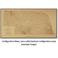
Configuration Maps
Configuration Maps, once called bedrock configuration maps (BCTs), show the contours of various rock layers. Many of these maps are print-on-demand, a copy is made from mylar, blue-line or cloth when the order is placed. Please allow additional time for delivery.
-

Thickness of Permian System, State (BCT-22)
$25.00 -

Thickness of Cimarron Series (Permian), State (BCT-23)
$15.00 -

Structural Contour, Top of Stone Corral (Permian), State (BCT-24)
$15.00 -

Structural Contour, Top of Pennsylvanian System, State (BCT-26)
$25.00 -

Thickness of Pennsylvanian System, State (BCT-27)
$15.00 -

Thickness of Virgil Series (Pennsylvanian), State (BCT-28)
$15.00 -
Structural Contour, Top of Lansing "B" (BCT-20.6)
$25.00 -

Structural Contour, Base of Kansas City Group (Pennsylvanian), State (BCT-30)
$25.00 -
Structural Contour, Base of Kansas City (BCT-20.5)
$25.00 -

Configuration of Precambrian Surface in Nebraska (BCT-32)
$25.00 -
Depth to Precambrian Rocks in Nebraska (BCT-33)
$25.00 -

Configuration Map of Top of the Devonian "Hunton" Carbonate in Nemaha and Richardson Counties (BCT-34)
$25.00